after the storm: Mapping deaths after the deadliest typhoon that hit the Philippines
November 8, 2013
Typhoon Haiyan, known as Typhoon Yolanda in the Philippines, made its first landfall in Guian, Eastern Samar after recording a 10-minute maximum sustained winds of 285 km/h. It is the deadliest typhoon to hit the country in recorded meteorological
history, leaving 6,300 dead, 1,074 missing, and 89.598 billion pesos worth of total damage. Due to the massive devastation caused by the typhoon in the country, issues of lack of preparation and institutional gaps in the country were uncovered, revealing that the government’s approach to disasters is more reactive rather than proactive. Had the country been more prepared on an institutional level, the extent of the damage might have not reached the level it actually had.
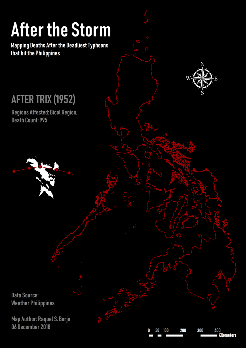
It is for this purpose that this map was conceptualized and made. By showing the death count not just from Typhoon Yolanda but also from each of the twenty (20) deadliest typhoons that hit the country, the map can highlight the regions that lost the most number of lives, and raise the right alarms in order to mitigate typhoon-related risks in the future. The data was gathered from Weather Philippines’ Worst Typhoons of the Philippines (1947-2014) list, which contains the typhoon names, period of occurrence, death count per storm, total damage in billion pesos, highest wind speed in KpH and where it was recorded, and the areas most affected. Since the death count cannot exactly be distributed to the regions / provinces included in the list, the typhoon was treated as one geographic region, and the death count was plotted on the map based on the new assigned region. Layers were
created per typhoon, and each layer was added on top of the previous one when exporting to show the aggregation of deaths after each typhoon, and highlight those regions that were affected the most.
As a side visual aid, the inset map shows the geographic area affected by the typhoon and the typhoon track, to give the audience an idea of the effects of meteorological events in relation to their paths.
Typhoon Haiyan, known as Typhoon Yolanda in the Philippines, made its first landfall in Guian, Eastern Samar after recording a 10-minute maximum sustained winds of 285 km/h. It is the deadliest typhoon to hit the country in recorded meteorological
history, leaving 6,300 dead, 1,074 missing, and 89.598 billion pesos worth of total damage. Due to the massive devastation caused by the typhoon in the country, issues of lack of preparation and institutional gaps in the country were uncovered, revealing that the government’s approach to disasters is more reactive rather than proactive. Had the country been more prepared on an institutional level, the extent of the damage might have not reached the level it actually had.
It is for this purpose that this map was conceptualized and made. By showing the death count not just from Typhoon Yolanda but also from each of the twenty (20) deadliest typhoons that hit the country, the map can highlight the regions that lost the most number of lives, and raise the right alarms in order to mitigate typhoon-related risks in the future. The data was gathered from Weather Philippines’ Worst Typhoons of the Philippines (1947-2014) list, which contains the typhoon names, period of occurrence, death count per storm, total damage in billion pesos, highest wind speed in KpH and where it was recorded, and the areas most affected. Since the death count cannot exactly be distributed to the regions / provinces included in the list, the typhoon was treated as one geographic region, and the death count was plotted on the map based on the new assigned region. Layers were
created per typhoon, and each layer was added on top of the previous one when exporting to show the aggregation of deaths after each typhoon, and highlight those regions that were affected the most.
As a side visual aid, the inset map shows the geographic area affected by the typhoon and the typhoon track, to give the audience an idea of the effects of meteorological events in relation to their paths.
