What is Fear?
Fear is a feeling that is triggered when an organism may suspect danger. This feeling is manifested in ways that are not limited to screaming and crying. Fear may turn into severe trauma that may forever change the way a human or a living object perceives things.
Fear itself is hard to plot on the map but events that may cause this are relatively visible. Fear is not only induced by first-hand experience as some events may create these feelings even by second-hand experiences.
What causes Fear?
Mapping the overall, collective feeling of people is not very practical to map out fear. While it may be possible, fear varies per person and may not be mapped as accurately due large differences in how one may respond to the feeling. Hence, responses to fear is out of the picture. Instead, I opted for a more general way of mapping out fear ― mapping events that people may experience in their day-to-day lives.
Generally, news reports are one of the many geographic ways of being able to map out current events. News reports include the names of the places, some provide scenes of where the event took place. News reports present not just the positive events that have occurred, most present negative reports* that a person must be careful about. Mapping takes place after the viewer has seen where things happen. Important things like typhoon tracks, expected areas to be affected by the typhoon, roads that will be closed for events, and crime-prone areas may be included in reports that are of geographic significance.

These forms of creating and representing space help citizens be more aware or cautious of their places. News Reports, to me, induce fear in a visual and informative way. They may define places and even create different impressions and perceptions on a specific place and to the people who reside in it. They may communicate urgency but the viewer may simply dismiss it as a mere threat, an attempt to cause panic. This is where the challenges for this form enters ― people who are familiar with their place will not believe these. People who have been living in an area may refuse to leave or evacuate disaster-prone areas because of the repetitiveness of what is presented.
|
Another way of mapping out fear is through their urban legends. Urban Legends are passed from generation to generation by storytelling, sharing, or by literary works.
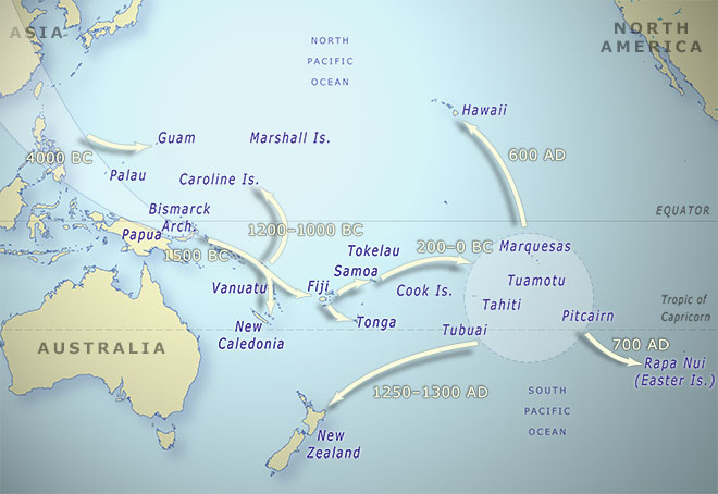
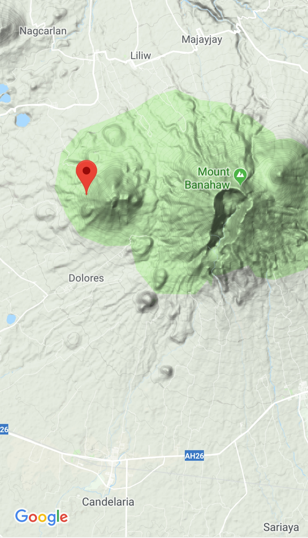
Urban Legends are geographic because they don’t just happen in small areas. They exist in large areas that are both rural and urban. These forms create space by means of associating supernatural beings to it. One example of what I found online was the map of Urban Legends across the United States of America. Most of which, include what seems to be different variations of the Sasquatch. The Philippine Islands have their fair share of eerie Urban Legends. Many of which are strictly associated to one area, others are observed in specific biomes and environments. I gathered two concrete maps to show the “Lost” city of Biringan and the opposite of Mt. Banahaw, Mt. Cristobal. Philippine examples that do not have a map but are known are the Kapres that live in large trees, The White Lady of Balete drive, and the “ghostly” hitch hikers one may encouter along expressways. What’s amazing is that Local Urban Legends are comparable to International Urban Legends; The Chupacabra and The Tikbalang, The Sasquatch and The Kapre, The Lost City of Atlantis and Biringan City in Samar. These associations may give people a sense of the beliefs in their area and may even be navigational especially if one chooses not to want to encounter these things. |
Killings that happen in different places affect the movement of people. In this case, it causes fear and would go as far as implementing safety precautions and laws to assure the safety of an area. These cause paranoia to the residents living around the vicinity. Extra Judicial Killings are a great example of how killing suspected drug users benefited the locals but encouraged great fear in certain areas.
Some people commended the initiative to deal with issues with drug users. Some communities have been unsafe due to the number of drug users and pushers that reside in a barangay. Reports of drug users committing murder and theft are two out of the many familiar things we would hear about them. The killings and chances to exploit the activity however quickly changed everything. The deaths increased, and not all of them were proven to be drug users. Some, if not most, were people seen in the streets or suspected to have been killed by either the police or the drug lords themselves. This has cause great fear that people might get killed regardless of where they are and who they are with. This also made families worry more about each other and may have lessened the visitors of a place. Various forms depicting these events may easily guide someone to creating a mental map of their place to avoid conflict. This form turns into a map through interpretation of the events and the place where it took place.
Some people commended the initiative to deal with issues with drug users. Some communities have been unsafe due to the number of drug users and pushers that reside in a barangay. Reports of drug users committing murder and theft are two out of the many familiar things we would hear about them. The killings and chances to exploit the activity however quickly changed everything. The deaths increased, and not all of them were proven to be drug users. Some, if not most, were people seen in the streets or suspected to have been killed by either the police or the drug lords themselves. This has cause great fear that people might get killed regardless of where they are and who they are with. This also made families worry more about each other and may have lessened the visitors of a place. Various forms depicting these events may easily guide someone to creating a mental map of their place to avoid conflict. This form turns into a map through interpretation of the events and the place where it took place.
|
In relation to the previous one, Terrorism is a relatively controversial topic to map. To me, i think is also hard to map because of how fast it shifts from area to area. Terrorist sites cause trauma to a greater society. Just one unknowing passerby can be affected and fall victim to the conflicts between the terrorist groups and armed forces especially if he or she is unaware of their surroundings. Maps of restricted areas and maps of terrorist-attack prone areas are readily available for the residents however, people would have to create a mental map with the use of sounds should a map be unavailable.
This goes for other situations that may involve mass death and threat like say a school shooting. The teacher would have to listen well to where gunshots are coming from to determine which hallways are safest to pass. Listening to where all the ruckus is coming from during an attack would help map out the area and identify the safest ways out or to hide into. These maps or ways of mapping would be able to not only benefit the residents of the areas but also the tourists or visitors of a country to somehow know how they will be approaching fearful residents. |

I cannot name a country that is entirely safe from natural hazards. Fear can be mapped out from natural hazards in two ways: identifying disaster-prone areas or re-evaluating and observing the patterns of disasters. Identifying disaster-prone areas would help local town planners the areas most suitable for human settlements while observing patterns would help the locals prepare for the next. Fear may be observed in the place that is most affected.
Fear from this would be caused by being there in the catastrophic event, during the preparations, and even after the event. To visualize, imagine two areas. One of which with minimal damages and the other of almost entirely wiping out mankind. Those who are experiencing minor effects would feel the threat of the worse possible effects and those who are already experiencing the worst would feel terrified of the only thing that may be threatening them, Death. This not only goes for those who have been affected but also those who are far from danger but have relatives in the affected area. This also makes it harder for survivors to be able to cope with the negative feelings inflicted upon them by the tragic event.
Fear from this would be caused by being there in the catastrophic event, during the preparations, and even after the event. To visualize, imagine two areas. One of which with minimal damages and the other of almost entirely wiping out mankind. Those who are experiencing minor effects would feel the threat of the worse possible effects and those who are already experiencing the worst would feel terrified of the only thing that may be threatening them, Death. This not only goes for those who have been affected but also those who are far from danger but have relatives in the affected area. This also makes it harder for survivors to be able to cope with the negative feelings inflicted upon them by the tragic event.

Creating the map
One way would be sound mapping. Sound mapping helps with one of the examples already given in this portfolio. Sound mapping works in a way that is helpful for already visually impaired mappers. Mapping out fear using existing spatial references and sounds would help in creating a map that would be useful in dangerous situations. It would also most likely help in observing patterns of movement or habitation.
Sound maps are created or tracked by listening to the range of certain sounds, to create this, areas must be definite or the sounds must be observed for long periods of time however, patterns should be long-term to be able to create an efficient map. Sound mapping will work best for temporary usage, maybe during an on-going warfare, police operations, or a construction area. This form of mapping is also useful when there is a need of immediate mapping as this simply requires the sense of hearing, but is not limited to it which means… Direct experiences can contribute to the creation of the map in every way.
Another way to illustrate fear is through art pieces. Art installations become geographic especially when they represent spatial entities. This includes and is not limited to images of places. The time and context within an image or piece. The pieces must be able to convey an image or sound of a physical region whether by events or by actual landmarks to successfully transmit hints of the areas of interest.
