renewable or fossil fuel? energy source of newly commissioned power plants in luzon
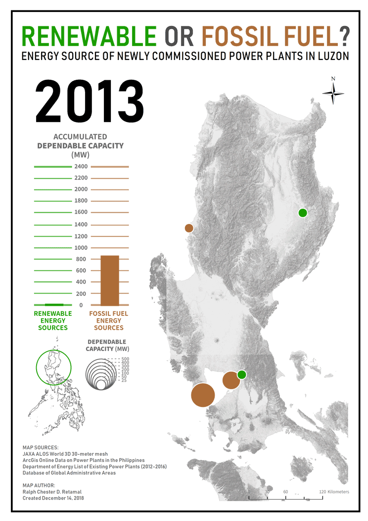
The map aims to show the trends in energy source of newly commissioned power plants in Luzon from 2013-2016. The initial data used in the map is a collated database of power plant listings taken from the online website of the Department of Energy. A dataset of points that can be found in ArcMap about the power plants present in the Philippines however, were eventually utilized instead in the map while the previously created database was used to counter check the information mapped. From the several information present in the database, two things were focused and utilized in the map. First is the kind of energy source of each power plant while second is the amount of dependable capacity that each power plant provides. Each power plant was mapped using points and is classified to either renewable (points in green) or fossil fuel (points in brown) energy sources. The amount of dependable capacity in megawatts of each power plant is depicted by the different point sizes. Graduated symbolization, therefore, was used in the map to communicate both information. The creation of the map itself can be really repetitive and tricky. However, the hardest part probably is finding the necessary data and properly plotting them in ArcMap. I initially wanted to manually plot the points but due to time constraints, data that can be retrieved in the search function of ArcMap were used instead in the map. This made the process of map making more manageable. Aside from spending a lot of effort, plotting points manually can also be time-consuming. Given the span of time provided to finish the map, it would be best to focus on making the map itself and not on plotting the points. With that said, I advise future beginning map makers to start their map by focusing on finding the necessary data before anything else. The conceptualization of what the map should be about or what it wants to communicate could come next after making sure that the map is first and foremost doable and the data needed are retrievable. Data that can already be easily added in ArcMap (such as kml point files or shape files) would also be more helpful. Adjustments concerning the map scope or objectives are sometimes necessary due to several constraints in logistics and the data itself. The mapmaker should be flexible enough to adjust these changes.
